Sources Lake Annecy

11-annecymountains-onmetlesvoiles-e21-1029
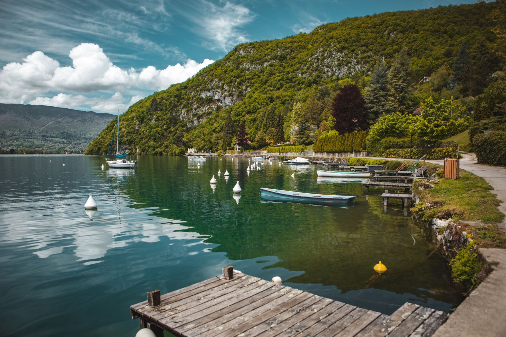
Sources Lake Annecy, whose name comes from the numerous waterfalls and rivers that feed Lake Annecy, is an area located at the southern end of the lake. Rich in mountains, waterways and beaches, the territory of the Sources du lac d'Annecy is the very definition of the gentle way of life. Located 35 minutes from Saint Jean de Sixt, there is a wide range of possible activities:
 

- hiking at La Sambuy or on the slopes of the Charbon mountain
- walks in the Bout du Lac Reserve and around the geo-sites of the Massif des Bauges regional nature park
- canyoning in the Nant de Montmin
- wakesurfing, sailing and paddling on Lake Annecy
- climbing at Marlens and via ferrata at La Sambuy
- cycling on the Epine, Forclaz and Tamié passes, or along the Annecy-Albertville cycle path
- mountain biking on the 100 km of marked trails of the destination
- paragliding, hang gliding, microlighting, hot air ballooning over Lake Annecy and with a view of Mont Blanc
- golf in Giez
- fishing at the Marlens-Val de Chaise lake
- swimming and relaxing on the beach at Doussard
- discovering the natural heritage of the caves and waterfalls of Seythenex
- cultural visits to villages and hamlets of character

Find all the information on Sources of Lake Annecy on their website : Tourist Office Sources of Lake Annecy

This territory includes 7 municipalities : Faverges-Seythenex, Doussard, Saint-Ferréol, Lathuile, Giez, Chevaline and Val de Chaise.
Faverges-Seythenex

As its name suggests, the commune is the result of the merger between the town of Faverges and the village of Seythenex in January 2016. This new commune has nearly 7900 inhabitants, the Favergiens and the Seytheneyards, and is part of the Massif des Bauges Regional Nature Park.

Faverges-Seythenex's advantage : the castle of Faverges, which used to house a weaving factory and then a silk factory and which still dominates the town from the top of its keep with a panoramic gallery. It has a very beautiful setting where weddings and other events are organised today.


Doussard
 
The commune of Doussard benefits from a privileged environment as it is part of the Massif des Bauges Regional Natural Park, labelled a Geopark by UNESCO, and is located a stone's throw from Lake Annecy. The three rivers of Doussard - the Ire, the Bornette and the Eau Morte - feed the lake.

Doussard's advantage : The nature reserve of Bout du Lac is a little corner of paradise in the peace and quiet, linked by a path to the beach of Doussard. You will discover a preserved nature, varied scenery and even a tower in which you can climb to enjoy a panoramic view of the lake.
Saint-Ferréol

The delightful village of Saint-Ferréol, nestled on the slopes of the Arclosan and Nantbellet mountains, has 818 inhabitants known as Saint-Ferréoliennes and Saint-Ferréoliens. Its history goes back at least to 750 BC, since traces of occupation dating from that period have been found.

Saint-Ferréol's advantage: its old sawmill and its paddle wheel, which give a unique charm to this pretty village.


Lathuile
 

The village of Lathuile is located in the Massif des Bauges Regional Nature Park, at the end of Lake Annecy and has more than 1000 inhabitants. Its main activities used to be agriculture and coal mining, which was definitively closed after the 2nd World War. The family of Saint-François de Sales was established there in the 17th century.

Lathuile's advantage : its ideal location close to the lake, the mountains and the town, while benefiting from a relaxing setting.
Giez

This small village, which lies between Faverges-Seythenex and Doussard, has a population of 450 inhabitants known as Gicans. It also belongs to the Massif des Bauges Regional Nature Park, which was awarded the UNESCO World Geopark label in 2015.
 
Giez's advantage : the Gy farm, a farm that was built around the outbuildings of the 17th century castle. A charming building with wooded facades, the perfect place to celebrate weddings and other festive events in a magical atmosphere.


Chevaline

Chevaline is the smallest commune of the Sources Lake Annecy, with just over 200 inhabitants - the Chevalinois and Chevalinoises - and is part of the Massif des Bauges Regional Nature Park.

Its origins probably date back to the Gallo-Roman period, as excavations have uncovered the foundations of houses dating back to that time. It was then called Caballina, a name which can have two origins : either it was founded by a certain Caballinus, or it was used for the maintenance of the Roman cavalry.

Chevaline's advantage : the rural heritage that can still be admired in the centre of the village with the bread oven, the pond, the traditional farms as well as the church dating from 1145.


Val de Chaise
 
The municipality of Val de Chaise is the result of the merger between Marlens and Cons Sainte Colombe in 2016 and takes its name from the river that runs through it and is called "La Chaise". It belongs to the Massif des Bauges Regional Nature Park, which was awarded the UNESCO World Geopark label in 2015.
 
Val de Chaise's advantage : the lime kilns of Cons Sainte Colombe which were exploited for more than a century, from 1750 to 1878, for the construction of numerous local buildings (such as the building of the Haute-Savoie prefecture) and which can be visited on certain occasions.
The other small Val de Chaise's advantage : the Marlens lake, a real little corner of paradise to recharge your batteries, to find yourself, to breathe.